Pitcairn Islands (UK)
Pitcairn 1936
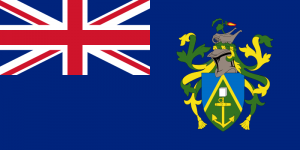
 Flag, Coat of Arms and Anthem: Come Ye Blessed, Royal anthem: God Save the Queen
The Pitcairn Islands (/ˈpɪtkɛərn/; Pitkern: Pitkern Ailen), officially named the Pitcairn, Henderson, Ducie and Oeno Islands, are a group of four volcanic islands in the southern Pacific Ocean that form a British Overseas Territory. The four islands – Pitcairn, Henderson, Ducie, and Oeno – are spread over several hundred miles of ocean and have a total land area of about 47 square kilometres (18 sq mi). Only Pitcairn, the second largest island measuring about 3.6 kilometres (2.2 mi) from east to west, is inhabited.
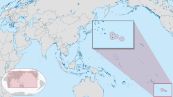 Location of the Pitcairn Islands relative to
the United Kingdom (white, top lefthand corner).
The islands are inhabited by the descendants of the Bounty mutineers and the Tahitians (or Polynesians) who accompanied them, an event retold in numerous books and films. This history is still apparent in the surnames of many of the islanders. With only about 48 inhabitants, originating from four main families, Pitcairn is the least populous jurisdiction in the world. The United Nations Committee on Decolonisation includes the Pitcairn Islands on the United Nations list of Non-Self-Governing Territories.
History of the Pitcairn Islands
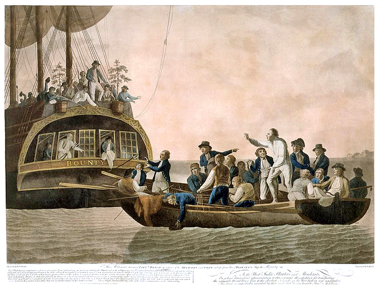 The mutineers turning Bligh and part of the officers and crew adrift from the Bounty, 29 April 1789
The earliest known settlers of the Pitcairn Islands were Polynesians who appear to have lived on Pitcairn and Henderson, as well as nearby Mangareva Island 400 kilometres (250 mi) to the northwest, for several centuries. They traded goods and formed social ties between the three islands despite the long canoe voyages between them, helping the small populations on each island survive despite having very limited resources. Eventually important natural resources were used up, inter-island trade broke down and a period of civil war began on Mangareva, causing the small human populations on Henderson and Pitcairn to be cut off and eventually go extinct. Although archaeologists believe that Polynesians were living on Pitcairn as late as the 15th century, the islands were uninhabited when they were discovered by Europeans.
Ducie and Henderson Islands were discovered by Portuguese sailor Pedro Fernandes de Queirós, sailing for the Spanish Crown, who arrived on 26 January 1606. He named them La Encarnación (“The Incarnation“) and San Juan Bautista (“Saint John the Baptist“), respectively. However, some sources express doubt about exactly which of the islands were visited and named by Queirós, suggesting that Queirós’ La Encarnación may actually have been Henderson Island, and San Juan Bautista may have been Pitcairn Island.
Pitcairn Island was sighted on 3 July 1767 by the crew of the British sloop HMS Swallow, commanded by Captain Philip Carteret. The island was named after Midshipman Robert Pitcairn, a fifteen-year-old crew member who was the first to sight the island. Robert Pitcairn was a son of British Marine officer John Pitcairn, who was killed in the American Revolution.
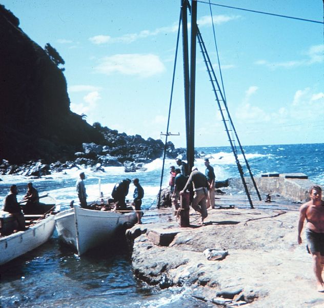 Geodesy collection on Pitcairn Island
Carteret, who sailed without the newly invented accurate marine chronometer, charted the island at 25° 2′ south and 133° 21′ west of Greenwich, but although the latitude was reasonably accurate, the longitude was incorrect by about 3°. This made Pitcairn difficult to find, as highlighted by the failure of Captain James Cook to locate the island in July 1773.
Habitation – Mutiny on the Bounty
In 1790, nine of the mutineers from the Bounty and Tahitian companions (six men, eleven women and a baby)—some of whom may have been kidnapped from Tahiti—settled on Pitcairn Island and set fire to the Bounty. The wreck is still visible underwater in Bounty Bay, discovered in 1957 by National Geographic explorer Luis Marden. Although the settlers survived by farming and fishing, the initial period of settlement was marked by serious tensions among them. Alcoholism, murder, disease and other ills took the lives of most mutineers and Tahitian men. John Adams and Ned Young turned to the scriptures using the ship’s Bible as their guide for a new and peaceful society. Young eventually died of an asthmatic infection. The Pitcairners also converted to Christianity; later they converted from their existing form of Christianity to Seventh-day Adventism after a successful Adventist mission in the 1890’s. After the rediscovery of Pitcairn, John Adams was granted amnesty for his mutiny.
The Pitcairn islanders reported that it was not until 27 December 1795 that the first ship since the Bounty was seen from the island, but as it did not approach the land, they could not make out to what nation it belonged. A second appeared some time in 1801, but did not attempt to communicate with them. A third came sufficiently near to see their habitations, but did not venture to send a boat on shore. The American trading ship Topaz under the command of Mayhew Folger was the first to visit the island and communicate with them when the crew spent 10 hours at Pitcairn in February 1808. A report of Folger’s find was forwarded to the Admiralty, mentioning the mutineers and a more precise location of the island—25° 2′ S latitude, 130° W longitude —however, this rediscovery was not known to Sir Thomas Staines, who commanded a Royal Navy flotilla of two ships (HMS Briton and HMS Tagus) which found the island at 25° 4′ S and 130° 25′ W (by meridian observation) on 17 September 1814. Staines sent a party ashore and wrote a detailed report for the Admiralty.
Ducie Island was rediscovered in 1791 by the British Captain Edwards aboard HMS Pandora, while searching for the Bounty mutineers. He named it after Francis Reynolds-Moreton, 3rd Baron Ducie, a captain in the Royal Navy. Henderson Island was rediscovered on 17 January 1819 by a British Captain James Henderson of the British East India Company ship Hercules. On 2 March 1819, Captain Henry King, sailing aboard the Elizabeth, landed on the island to find the king’s colours already flying. His crew scratched the name of their ship into a tree, and for some years the island’s name was Elizabeth or Henderson. Oeno Island was discovered on 26 January 1824 by US Captain George Worth aboard the whaler Oeno.
British Colony
Pitcairn Island became a British colony in 1838, and was among the first territories to extend voting rights to women. By the mid-1850s, the Pitcairn community was outgrowing the island and its leaders appealed to the British government for assistance. They were offered Norfolk Island, and on 3 May 1856, the entire community of 193 people set sail for Norfolk on board the Morayshire, arriving on 8 June after a miserable five-week trip. But after eighteen months on Norfolk, seventeen of the Pitcairners returned to their home island; five years later another twenty-seven did the same.
In 1902, Henderson, Oeno and Ducie islands were annexed by Britain: Henderson on 1 July, Oeno on 10 July and Ducie on 19 December. In 1938, the three islands, along with Pitcairn, were formally incorporated into a single administrative unit called the “Pitcairn Group of Islands.”
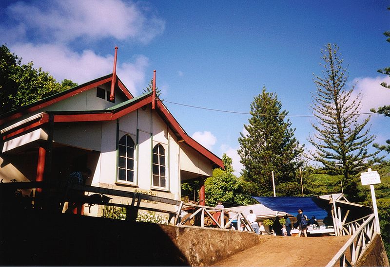 Church of Adamstown
The population peaked at 233 in 1937, and has since fallen due to emigration, primarily to New Zealand, leaving some fifty people living on Pitcairn.
Pitcairn Sexual Assault Trial of 2004
In 2004, charges were laid against seven men living on Pitcairn and six living abroad. The island held the record for highest number of sex offenders per capita. After extensive trials the men were convicted, some with multiple counts of sexual attacks of children. On 25 October 2004, six men were convicted, including Steve Christian, the island’s mayor at the time. After the six men lost their final appeal, the British government set up a prison on the island at Bob’s Valley. The men began serving their sentences in late 2006. By 2010, all had served their sentences or been granted home detention status.
Geography of the Pitcairn Islands
The Pitcairn Islands form the southeasternmost extension of the geological archipelago of the Tuamotus of French Polynesia, and consist of four islands: Pitcairn Island, Oeno Island (atoll with five islets, one of which is Sandy Island), Henderson Island and Ducie Island (atoll with four islets).
The Pitcairn Islands were formed by a centre of upwelling magma called the Pitcairn hotspot.
The only permanently inhabited island, Pitcairn, is accessible only by boat through Bounty Bay. Henderson Island, covering about 86% of the territory’s total land area and supporting a rich variety of animals in its nearly inaccessible interior, is also capable of supporting a small human population despite its scarce fresh water, but access is difficult, owing to its outer shores being steep limestone cliffs covered by sharp coral. In 1988 this island was designated as a UNESCO World Heritage site. The other islands are at a distance of more than 100 km (62 mi) and are not habitable.
