Northern Mariana Islands

2nd Edition of ‘History of Mariana Islands’ Published
A book has been finished chronicling all aspects of the rich history of the Guam and the Northern Mariana Islands. Its author is here, exhibiting his work and thanking the local resources that contributed greatly to this very worthwhile project.
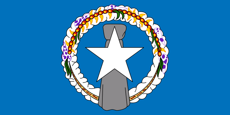 Flag
Flag
The Northern Mariana Islands, officially the Commonwealth of the Northern Mariana Islands (CNMI; Chamorro: Sankattan Siha Na Islas Mariånas), is one of the five inhabited U.S. territories (the other four being Guam, Puerto Rico, the U.S. Virgin Islands and American Samoa). It is also one of two territories that have a “commonwealth” status (See Commonwealths; the other is Puerto Rico). It consists of fifteen islands in the western Pacific Ocean located about three-quarters of the way between Hawaii and the Philippines. The United States Census Bureaureports the total land area of all islands as 183.5 square miles (475.26 km2). As of the 2010 census, the Commonwealth has a population of 53,883, of which over 90% live on the island of Saipan. Of the fourteen other islands, only two – Tinian and Rota – are permanently inhabited.
The Commonwealth’s center of government is in the village of Capital Hill on Saipan. As the island is governed as a single municipality, most publications name Saipan as the Commonwealth’s capital.
Geography
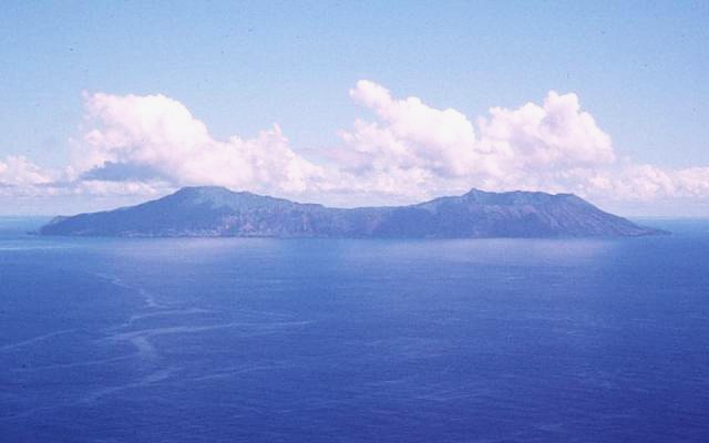 Anatahan Island – Extreme points of the Northern Mariana Islands
The Northern Mariana Islands, together with Guam to the south, compose the Mariana Islands archipelago. The southern islands are limestone, with level terraces and fringing coral reefs. The northern islands are volcanic, with active volcanoes on several islands, including Anatahan, Pagan and Agrihan. The volcano on Agrihan has the highest elevation at 3,166 feet (965 m).
Anatahan Volcano is a small volcanic island 80 miles (130 km) north of Saipan. It is about 6 miles (10 km) long and 2 miles (3 km) wide. Anatahan began erupting from its east crater on May 10, 2003, at about 6 p.m. (0800 UTC). It has since alternated between eruptive and calm periods. On April 6, 2005, approximately 1,800,000 cubic feet (50,970 m3) of ash and rock were ejected, causing a large, black cloud to drift south over Saipan and Tinian.
Climate
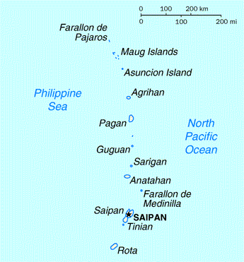 Map of the Northern Mariana Islands.
The North Mariana Islands have a tropical marine climate moderated by seasonal northeast trade winds. There is little seasonal temperature variation. The dry season runs from December to June, and the rainy season from July to November and can include typhoons. The Guinness Book of World Records has cited Saipan as having the most equable temperature in the world.
History – Arrival of Chamorros and Refaluwasch
The first people of the Northern Mariana Islands navigated to the islands at some period between 4000 BC to 2000 BC from Southeast Asia. They became known as the Chamorros, and spoke an Austronesian language called Chamorro. The ancient Chamorro left a number of megalithic ruins, including Latte stone. The Refaluwasch, or Carolinian, people came to the Marianas in the 1800s from the Caroline Islands.
Spanish Possession
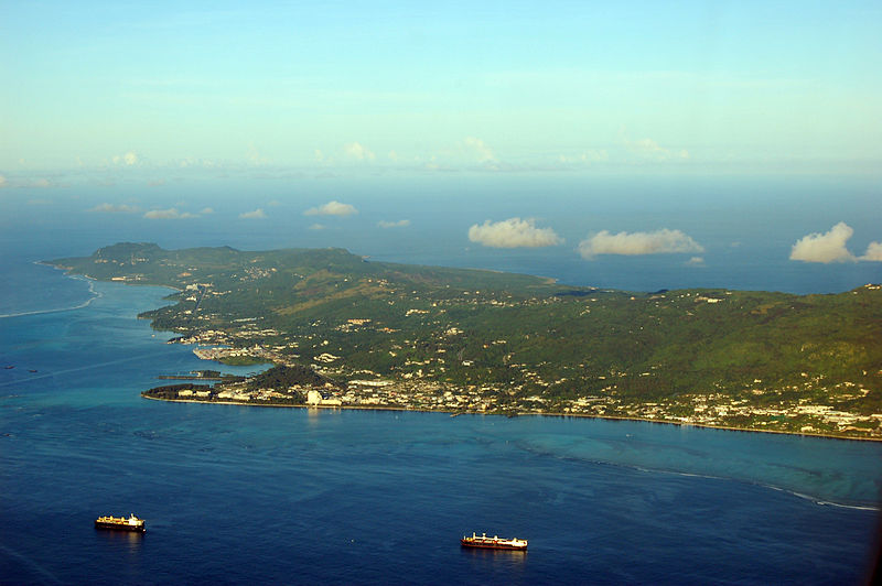 The island of Saipan.
The first European exploration of the area was in 1521 by Ferdinand Magellan, who landed on nearby Guam and claimed the islands for Spain. The Spanish ships were met offshore by the native Chamorros, who delivered refreshments and then helped themselves to a small boat belonging to Magellan’s fleet. This led to a cultural clash, since in Chamorro tradition there was little private property and taking something one needed, such as a boat for fishing, was not considered stealing. The Spanish did not understand this custom. The Spanish fought against the local Chamorro until the boat was recovered. Three days after he had been welcomed on his arrival, Magellan fled the archipelago under attack.
In 1565, Miguel López de Legazpi arrived in Guam and took possession of the islands in the name of the Spanish Crown.
Guam was an important stop-over for the Manila Galleons, a convoy of ships carrying passengers and cargo such as silver, plants and animals from Acapulco (Mexico) to Manila. On the return trip from the Philippines to Mexico, the galleons did not call at Guam as the eastern winds were farther north, near the coast of Japan.
Most of the islands’ native population (90–95%) died from Spanish diseases or married non-Chamorro settlers under Spanish rule. New settlers, primarily from the Philippines and the Caroline Islands, were brought to repopulate the islands. The Chamorro population did gradually recover, and Chamorro, Filipino and Carolinian languages and other ethnic differences remain in the Marianas.
Spanish colonists forced the Chamorros to be concentrated on Guam to encourage assimilation and conversion to Roman Catholicism. By the time Chamorros were allowed to return to the Northern Marianas, many Carolinians from present-day eastern Yap State and western Chuuk State had settled in the Marianas. Carolinians and Chamorros now are both considered as indigenous and both languages are official in the Commonwealth, though not on Guam.
German and Japanese Possession
Following the Spanish–American War of 1898, Spain ceded Guam to the United States and sold the remainder of the Marianas, along with the Caroline Islands, to the German Empire under the German–Spanish Treaty of 1899. Germany administered the islands as part of the colony of German New Guinea and did little in terms of development.
Early in World War I, the Empire of Japan declared war on Germany and invaded the Northern Marianas. In 1919, the League of Nations awarded the islands to Japan, and the Japanese administered them as part of the South Pacific Mandate. During the Japanese period, sugar cane became the main industry of the islands. Garapan on Saipan was developed as a regional capital, and numerous Japanese (including ethnic Koreans, Okinawan and Taiwanese immigrated to the islands. In the census of December 1939, the total population of the South Pacific Mandate was 129,104, of which 77,257 were Japanese (including ethnic Taiwanese and Koreans). On Saipan the population before the war 29,348 Japanese settlers and 3,926 Chamorro and Caroline Islanders; Tinian had 15,700 Japanese settlers (including 2700 ethnic Koreans and 22 ethnic Chamorro).
Hours after the Attack on Pearl Harbor, Japanese forces from the Marianas launched an invasion of Guam on December 8, 1941. Chamorros from the Northern Marianas, then under Japanese rule for more than two decades, were brought to Guam to assist the Japanese administration. This, combined with the harsh treatment of Guamanian Chamorros during the 31-month occupation, created a rift that would become the main reason Guamanians rejected the reunification referendum approved by the Northern Marianas in the 1960’s.
World War II
Near the end of World War II, the United States military invaded the Mariana Islands on June 15, 1944, beginning with the Battle of Saipan, which ended on July 9. Of the 30,000 Japanese troops that defended Saipan, fewer than 1,000 remained alive at battle’s end. Over 20,000 Japanese civilians were also killed, or committed suicide rather than be captured. U.S. forces then recaptured Guam beginning July 21, and invaded Tinian (see Battle of Tinian) on July 24, which provided the take off point for the Enola Gay, the plane dropping the atomic bomb on Hiroshima a year later. Rota was left untouched (and isolated) until the Japanese surrender in August 1945, due to its military insignificance. The war did not end for everyone with the signing of the armistice. The last group of Japanese holdouts surrendered on Saipan on December 1, 1945. On Guam, Japanese soldier Shoichi Yokoi, unaware that the war had ended, hid in a jungle cave in the Talofofo area until 1972.
After the end of the war, Japanese nationals were eventually repatriated to the Japanese home islands.
Commonwealth
After Japan’s defeat, the islands were administered by the United States as part of the United Nations Trust Territory of the Pacific Islands; which gave responsibility for defense and foreign affairs to the United States. Four referenda on either integration with Guam or the islands’ status were held in 1958, 1961, 1963 and 1969. On each occasion a majority voted in favor of integration with Guam. However, the proposal remained unfulfilled, with Guam rejecting integration in a 1969 referendum. The people of the Northern Mariana Islands decided in the 1970s not to seek independence, but instead to forge closer links with the United States. Negotiations for territorial status began in 1972 and a covenant to establish a commonwealth in political union with the United States was approved in a 1975 referendum. A new government and constitution went into effect in 1978 after being approved in a 1977 referendum. Similar to other U.S. territories, the islands do not have representation in the U.S. Senate, but are represented in the U.S. House of Representatives by a delegate (beginning January 2009 for the CNMI) who may vote in committee but not on the House floor.
