Norfolk Island
Norfolk Island
Travel Oz head to Norfolk Island in celebration of Bounty Day, full of rich history and culture.
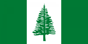
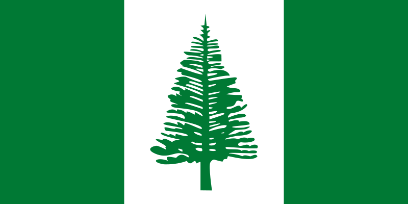 Flag
Flag
Originally settled by East Polynesians, Norfolk Island was colonised by Great Britain as part of its settlement of Australia in 1788. The island served as a convict penal settlement until May 1855, except for an 11-year hiatus between 1814 and 1825, when it was abandoned. In 1856 permanent civilian residence on the island began when it was settled from Pitcairn. In 1901, the island became a part of the Commonwealth of Australia which it has remained until this day.Norfolk Island (![]() i/ˈnɔrfək ˈaɪlənd/; Norfuk: Norf’k Ailen[4]) is a small island in thePacific Ocean located between Australia, New Zealand and New Caledonia, 1,412 kilometres (877 mi) directly east of mainland Australia’s Evans Head, and about 900 kilometres (560 mi) from Lord Howe Island. The island is part of the Commonwealth of Australia, but it enjoys a large degree of self-governance. Together with two neighbouring islands, it forms one of Australia’s external territories. It has 2,300 people living on 35 km2. Its capital is Kingston.
i/ˈnɔrfək ˈaɪlənd/; Norfuk: Norf’k Ailen[4]) is a small island in thePacific Ocean located between Australia, New Zealand and New Caledonia, 1,412 kilometres (877 mi) directly east of mainland Australia’s Evans Head, and about 900 kilometres (560 mi) from Lord Howe Island. The island is part of the Commonwealth of Australia, but it enjoys a large degree of self-governance. Together with two neighbouring islands, it forms one of Australia’s external territories. It has 2,300 people living on 35 km2. Its capital is Kingston.
The evergreen Norfolk Island pine is a symbol of the island and thus pictured on itsflag (see illustration). Native to the island, the pine is a key export industry for Norfolk Island, being a popular ornamental tree on mainland Australia, where two related species grow, and also in Europe.
History of Norfolk Island – Early History
Norfolk Island was first settled by East Polynesian seafarers either from the Kermadec Islands north of New Zealand or from the North Island of New Zealand. They arrived in the fourteenth or fifteenth century, and survived for several generations before disappearing.
The first European known to have sighted the island was Captain James Cook, in 1774, on his second voyage to the South Pacific on HMS Resolution. He named it after Mary Howard, Duchess of Norfolk (c. 1712 – 1773).
Sir John Call argued the advantages of Norfolk Island in that it was uninhabited and that flax grew there. In 1786 the British government included Norfolk Island as an auxiliary settlement, as proposed by John Call, in its plan for colonization of New South Wales. The decision to settle Norfolk Island was taken due to Empress Catherine II of Russia‘s decision to restrict sales of hemp. Practically all the hemp and flax required by the Royal Navy for cordage and sailcloth was imported from Russia.
When the First Fleet arrived at Port Jackson in January 1788, Captain Arthur Phillip ordered Lieutenant Philip Gidley King to lead a party of 15 convicts and seven free men to take control of Norfolk Island and prepare for its commercial development. They arrived on 6 March 1788.
During the first year of the settlement, which was also called “Sydney” like its parent, more convicts and soldiers were sent to the island from New South Wales.
Nineteenth Century
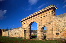 Norfolk Island gaol
As early as 1794, Lieutenant-Governor of New South Wales Francis Grose suggested its closure as a penal settlement, as it was too remote and difficult for shipping and too costly to maintain. The first group of people left in February 1805, and by 1808 only about 200 remained, forming a small settlement until the remnants were removed in 1813. A small party remained to slaughter stock and destroy all buildings, so that there would be no inducement for anyone, especially from other European powers, to visit and lay claim to the place. From 15 February 1814 to 6 June 1825 the island was abandoned.
In 1824 the British government instructed the Governor of New South Wales Thomas Brisbane to occupy Norfolk Island as a place to send “the worst description of convicts”. Its remoteness, previously seen as a disadvantage, was now viewed as an asset for the detention of recalcitrant male prisoners. The convicts detained have long been assumed be a hardcore of recidivists, or ‘doubly-convicted capital respites’ – that is, men transported to Australia who committed fresh colonial crimes for which they were sentenced to death, and were spared the gallows on condition of life at Norfolk Island. However, a recent study has demonstrated, utilising a database of 6,458 Norfolk Island convicts, that the reality was somewhat different: more than half were detained at Norfolk Island without ever receiving a colonial conviction, and only 15% had been reprieved from a death sentence. Furthermore, the overwhelming majority of convicts sent to Norfolk Island had committed non-violent property sentences, and the average length of detention was three years.
The second penal settlement began to be wound down by the British government after 1847, and the last convicts were removed to Tasmania in May 1855. The island was abandoned because transportation from the United Kingdom to Van Diemen’s Land had ceased in 1853, to be replaced by penal servitude in the UK.
On 8 June 1856, the next settlement began on Norfolk Island. These were the descendants of Tahitians and the HMS Bountymutineers, including those of Fletcher Christian. They resettled from the Pitcairn Islands, which had become too small for their growing population. They left Pitcairn Islands on 3 May 1856 and arrived with 194 persons on 8 June. The Pitcairners occupied many of the buildings remaining from the penal settlements, and gradually established traditional farming and whaling industries on the island. Although some families decided to return to Pitcairn in 1858 and 1863, the island’s population continued to grow. They accepted additional settlers, who often arrived with whaling fleets.
In 1867, the headquarters of the Melanesian Mission of the Church of England was established on the island. In 1920 the Mission was relocated from Norfolk Island to the Solomon Islands to be closer to the population of focus.
Post-Nineteenth Century
After the creation of the Commonwealth of Australia in 1901, Norfolk Island was placed under the authority of the new Commonwealth government to be administered as an external territory. During World War II, the island became a key airbase and refuelling depot between Australia and New Zealand, and New Zealand and the Solomon Islands. Since Norfolk Island fell within New Zealand’s area of responsibility it was garrisoned by a New Zealand Army unit known as N Force at a large Army camp which had the capacity to house a 1,500 strong force. N Force relieved a company of the Second Australian Imperial Force. The island proved too remote to come under attack during the war and N Force left the island in February 1944.
In 1979, Norfolk was granted limited self-government by Australia, under which the island elects a government that runs most of the island’s affairs. As such, residents of Norfolk Island are not represented in the Commonwealth Parliament of Australia, making them the only group of residents of an Australian state or territory not represented there.
In 2006, a formal review process took place, in which the Australian government considered revising this model of government. The review was completed on 20 December 2006, when it was decided that there would be no changes in the governance of Norfolk Island.
Financial problems and a reduction in tourism led to Norfolk Island’s administration appealing to the Australian federal government for assistance in 2010. In return, the islanders were to pay income tax for the first time but would be eligible for greater welfare benefits. However, by May 2013 agreement had not been reached and islanders were having to leave to find work and welfare.
Geography
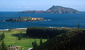 View across to Nepean Island (foreground) and Phillip Island

Map of Norfolk Island
Norfolk Island is located in the South Pacific Ocean, east of the Australian mainland. Norfolk Island is the main island of the island group the territory encompasses and is located at 29°02′S 167°57′E. It has an area of 34.6 square kilometres (13.4 sq mi), with no large-scale internal bodies of water and 32 km (20 mi) of coastline. The island’s highest point is Mount Bates (319 metres (1,047 feet) above sea level), located in the northwest quadrant of the island. The majority of the terrain is suitable for farming and other agricultural uses. Phillip Island, the second largest island of the territory, is located at 29°07′S 167°57′E, seven kilometres (4.3 miles) south of the main island.
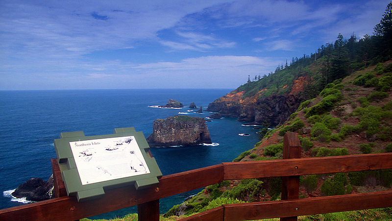 Captain Cook lookout within the Norfolk Island National Park
The coastline of Norfolk Island consists, to varying degrees, of cliff faces. A downward slope exists towards Slaughter Bay and Emily Bay, the site of the original colonial settlement of Kingston. There are no safe harbour facilities on Norfolk Island, with loading jetties existing at Kingston and Cascade Bay. All goods not domestically produced are brought in by ship, usually to Cascade Bay. Emily Bay, protected from the Pacific Ocean by a small coral reef, is the only safe area for recreational swimming, although surfing waves can be found at Anson and Ball Bays.
The climate is subtropical and mild, with little seasonal differentiation. The island is the eroded remnant of a basaltic volcano active around 2.3 to 3 million years ago, with inland areas now consisting mainly of rolling plains. It forms the highest point on the Norfolk Ridge, part of the submerged continent Zealandia.
The area surrounding Mount Bates is preserved as the Norfolk Island National Park. The park, covering around 10% of the land of the island, contains remnants of the forests which originally covered the island, including stands of subtropical rainforest.
The park also includes the two smaller islands to the south of Norfolk Island, Nepean Island and Phillip Island. The vegetation of Phillip Island was devastated due to the introduction during the penal era of pest animals such as pigs and rabbits, giving it a red-brown colour as viewed from Norfolk; however, pest control and remediation work by park staff has recently brought some improvement to the Phillip Island environment.
The major settlement on Norfolk Island is Burnt Pine, located predominantly along Taylors Road, where the shopping centre, post office, liquor store, telephone exchange and community hall are located. Settlement also exists over much of the island, consisting largely of widely separated homesteads.
Government House, the official residence of the Administrator, is located on Quality Row in what was the penal settlement of Kingston. Other government buildings, including the court, Legislative Assembly and Administration, are also located there. Kingston’s role is largely a ceremonial one, however, with most of the economic impetus coming from Burnt Pine.
