Marshall Islands
Collateral Damage: Atomic Testing in the Marshall Islands
Between 1946 and 1958, the U.S. detonated 67 nuclear devices in and around the Marshall Islands. The impact of these tests on the Marshallese people was profound – in terms of both actual radioactive exposure and the displacement of people from their home islands due to contamination and to accommodate the U.S. military. This clip is excerpted from Episode 6 of “UNNATURAL CAUSES: Is Inequality Making Us Sick?”, a ground-breaking documentary series that looks at how the social, economic and physical environments in which we are born, live, and work profoundly affect our longevity and health. The series broadcast nationally on PBS in spring 2008, and can be bought on DVD from California Newsreel, www.newsreel.org.
 Flag
Flag
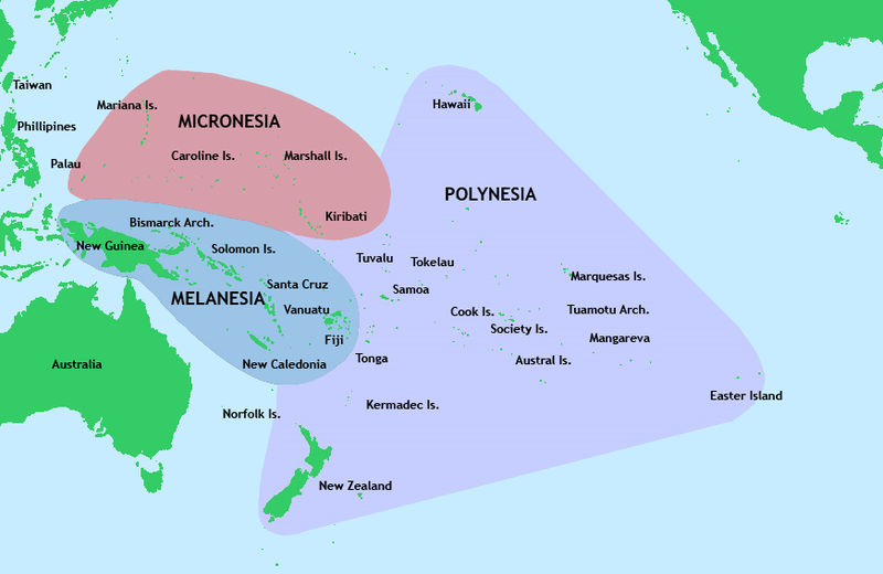
The Marshall Islands, officially the Republic of the Marshall Islands (Marshallese:Aolepān Aorōkin M̧ajeļ), is an island country located in the northern Pacific Ocean. Geographically, the country is part of the larger island group of Micronesia, with the population of 68,480 people spread out over 24 low-lying coral atolls, comprising 1,156 individual islands and islets. The islands share maritime boundarieswith the Federated States of Micronesia to the west, Wake Island to the north, Kiribati to the south-east, and Nauru to the south. The most populous atoll is Majuro, which also acts as the capital.
Micronesian colonists gradually settled the Marshall Islands during the 2nd millennium BC, with inter-island navigation made possible using traditional stick charts. Islands in the archipelago were first explored by Europeans in the 1520’s, with Spanish explorer Alonso de Salazar sighting an atoll in August 1526. Other expeditions by Spanish and English ships followed, with the islands’ current name stemming from British explorer John Marshall. Recognised as part of the Spanish East Indies in 1874, the islands were sold to Germany in 1884, and became part of German New Guinea in 1885. TheEmpire of Japan occupied the Marshall Islands in World War I, which were later joined with other former German territories in 1919 by the League of Nations to form the South Pacific Mandate. In World War II, the islands were conquered by the United States in the Gilbert and Marshall Islands campaign. Along with other Pacific Islands, the Marshall Islands were then consolidated into the United-States-governed Trust Territory of the Pacific Islands. Self-government was achieved in 1979, and full sovereignty in 1986, under a Compact of Free Association with the United States.
Politically, the Marshall Islands is a presidential republic in free association with the United States, with the US providing defense, funding grants, and access to social services. Having few natural resources, the islands’ wealth is based on a service economy, as well as some fishing and agriculture, with a large percentage of the islands’ gross domestic product coming from United States aid. The country uses theUnited States dollar as its currency. The majority of citizens of the Marshall Islands are of Marshallese descent, with small numbers of immigrants from the Philippinesand other Pacific islands. The two official languages are Marshallese, a member of the Malayo-Polynesian languages, and English. Almost the entire population of the islands practises some religion, with three-quarters of the country either following the United Church of Christ – Congregational in the Marshall Islands (UCCCMI) or the Assemblies of God.
History of the Marshall Islands
The Marshall Islands were settled by Micronesians in the 2nd millennium BC. Little is known of this early history. People traveled by canoe between islands using traditional stick charts.
Spanish Exploration
 Spanish explorer Alonso de Salazar was the first European to see the islands in 1526, commanding the ship Santa Maria de la Victoria, the only surviving vessel of the Loaísa Expedition. On August 21, he sighted an island at 14°N that they named “San Bartolome” (probably Taongi).
On September 21, 1529, Álvaro de Saavedra Cerón commanded the Spanish ship Florida, on his second attempt to recross the Pacific from the Maluku Islands. He stood off a group of islands from which several natives came off and hurled stones at his ship. These islands, named by him “Los Pintados,” may have been Ujelang. On October 1, he found another group of islands where he went ashore for eight days, exchanged gifts with natives and took on water. These islands, “Los Jardines,” could be Eniwetok orBikini Atoll.
The Spanish ship San Pedro and two other vessels in an expedition commanded by Miguel Lopez de Legazpi on January 9, 1530, discovered an island at 10°N where they went ashore and traded with natives and named it “Los Barbudos” (possibly Mejit). On January 10, they sighted another island that they named “Placeres” (perhaps Ailuk), ten leagues away, they sighted another island that they called “Pajares” (perhaps Jemo). On January 12, they sighted another island at 10°N which they called “Corrales” (possibly Wotho). On January 15, another low island was sighted at 10°N (perhaps Ujelang) where they made a good description of the people on “Barbudos.” After that, ships like San Jeronimo, Los Reyes, Todos los Santos also visited the islands in different years.
Other European Exploration
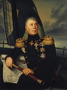 Adam Johann von Krusenstern
Captain John Charles Marshall together with Thomas Gilbert came to the islands in 1788. The islands were named after John Marshall by the Russian explorer Adam Johann von Krusenstern and the French explorer Louis Isidore Duperrey, who drew maps of the islands circa 1820. The designation was repeated later on British maps. Spain claimed sovereignty over the islands as part of the Spanish East Indies. In 1874, Spanish sovereignty was recognized by the international community. Spain sold the islands to Germany in 1884 through papal mediation.
German Protectorate – German New Guinea
Although Spain had a residual claim on the Marshalls in 1874, when she began asserting her sovereignty over the Carolines, she made no effort to prevent Germany from gaining a foothold there. Britain in turn raised no objection to a German protectorate over the Marshalls in exchange for German recognition of Britain’s rights in the Gilbert and Ellice Islands. On October 13, 1885, SMS Nautilus under Captain Rötger brought German emissaries to Jaluit. They signed a treaty with Kabua, whom the Germans had earlier recognised as “King of the Ralik Islands”, on October 15. The treaty in German and Marshallese was subsequently signed by seven other chiefs (on seven other islands) and a final copy witnessed by Rötger on November 1 was sent to the German Foreign Office. A sign declaring “Imperial German Protectorate” was erected at Jaluit. It has been speculated that the crisis over the Carolines with Spain, which almost provoked a war, was in fact “a feint to cover the acquisition of the Marshall Islands”, which went almost unnoticed at the time, despite their being the largest source of copra in Micronesia.
A German trading company, the Jaluit Gesellschaft, administered the islands from 1887 until 1905. After the German–Spanish Treaty of 1899, in which Germany acquired the Carolines, Palau, and the Marianas, Germany placed all of its Micronesian islands, including the Marshalls, under the governor of German New Guinea.
Japanese Mandate – South Pacific Mandate
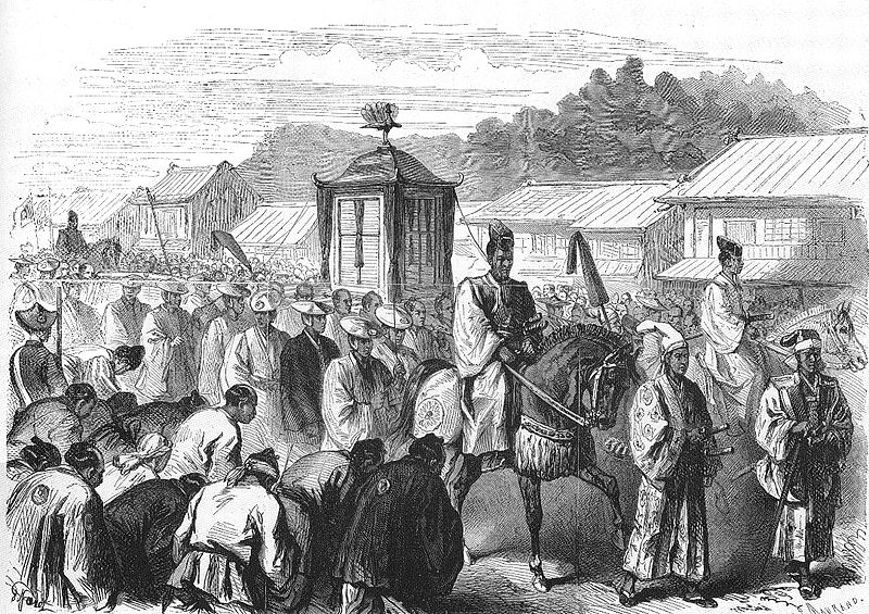 The Meiji Emperor, moving from Kyoto to Tokyo, end of 1868.
Under German control, and even before then, Japanese traders and fishermen from time to time visited the Marshall Islands, although contact with the islanders was irregular. After the Meiji Restoration (1868), the Japanese government adopted a policy of turning Japan into a great economic and military power in East Asia.
In 1914, Japan joined the Entente during World War I, and captured various German colonies including several in Micronesia. On September 29, 1914, Japanese troops occupied the Enewetak Atoll, and on September 30, 1914, the Jaluit Atoll, the administrative center of the Marshall Islands. After the war, on June 28, 1919, Germany renounced all of its Pacific possessions, including the Marshall Islands. On December 17, 1920, the Council of the League of Nations approved the mandate for Japan to take over all former German colonies in the Pacific Ocean located north of the equator. The Administrative Center of the Marshall Islands atoll remained Jaluit.
The German Empire had primarily economic interests in Micronesia. The Japanese interests were in land. Despite the Marshalls’ small area and few resources, the absorption of the territory by Japan would to some extent alleviate Japan’s problem of an increasing population with a diminishing amount of available land to house it. During its years of colonial rule, Japan moved more than 1,000 Japanese to the Marshall Islands although they never outnumbered the indigenous peoples as they did in the Mariana Islands and Palau.
The Japanese enlarged administration and appointed local leaders, which weakened the authority of local traditional leaders. Japan also tried to change the social organization in the islands from Matrilineality to the Japanese Patriarchal system, but with no success. Moreover, during the 1930s, one third of all land up to the high water level was declared the property of the Japanese government. On the archipelago, before it banned foreign traders, the activities of Catholic and Protestant missionaries were allowed. Indigenous people were educated in Japanese schools, and studied Japanese language and Japanese culture. This policy was the government strategy not only in the Marshall Islands, but on all the other mandated territories in Micronesia. On March 27, 1933, Japan left the League of Nations, but continued to manage the islands, and in the late 1930’s began building air bases on several atolls. The Marshall Islands were in an important geographical position, being the easternmost point in Japan’s defensive ring at the beginning of World War II.
World War II
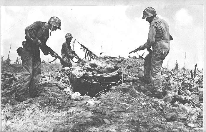 US troops inspecting an enemy bunker, Kwajalein Atoll. 1944.
In the months before the attack on Pearl Harbor, Kwajalein Atoll was the administrative center of the Japanese 6th Fleet Forces Service, whose task was the defense of the Marshall Islands.
In World War II, the United States, during the Gilbert and Marshall Islands campaign, invaded and occupied the islands in 1944, destroying or isolating the Japanese garrisons. The US government added the archipelago to the U.S. Trust Territory of the Pacific Islands, along with several other island groups in the South Sea.
The battle in the Marshall Islands caused irreparable damage, especially on Japanese bases. During the American bombing, the islands’ population suffered from lack of food and various injuries.
U.S. attacks started in mid-1943, and caused half the Japanese garrison of 5,100 people in the atoll Mili to die from hunger by August 1945. In just one month in 1944, Americans captured Kwajalein Atoll, Majuro and Enewetak, and in the next two months the rest of the Marshall Islands except Wotje, Mili, Maloelap and Jaluit.
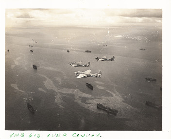 Shipping Lane Patrol Kwajalein Island (Marshall Islands-April 1945)
Nuclear tests after World War II
Trust Territory of the Pacific Islands
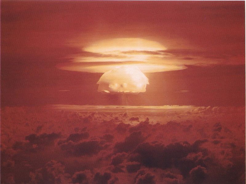 Mushroom cloud from the largest nuclear test the United States ever conducted, Castle Bravo.
From 1946 to 1958, as the site of the Pacific Proving Grounds, the U.S. tested 67nuclear weapons in the Marshall Islands, including the largest nuclear test the U.S. ever conducted, Castle Bravo. In 1956, the Atomic Energy Commission regarded the Marshall Islands as “by far the most contaminated place in the world.”
Nuclear claims between the U.S. and the Marshall Islands are ongoing, and health effects from these nuclear tests linger. Project 4.1 was a medical study conducted by the United States of those residents of the Bikini Atoll exposed to radioactive fallout. From 1956 to August 1998, at least $759 million was paid to the Marshallese Islanders in compensation for their exposure to U.S. nuclear testing.
With the 1952 test of the first U.S. hydrogen bomb, code named “Ivy Mike“, the island of Elugelab in the Enewetak atoll was destroyed.
Independence
In 1979, the Government of the Marshall Islands was officially established and the country became self-governing.
In 1986, the Compact of Free Association with the United States entered into force, granting the Republic of the Marshall Islands (RMI) its sovereignty. The Compact provided for aid and U.S. defense of the islands in exchange for continued U.S. military use of the missile testing range at Kwajalein Atoll. The independence procedure was formally completed under international law in 1990, when the UN officially ended the Trusteeship status.
