History of Rockaway, NJ
The following introduction by Mary Electa Robinson is excerpted from Remembering Rockaway, edited by Dorothy E. Mott. The current MapQuest map of Rockaway may help in following the story.
Rockaway Village: How it Grew
When Rockaway Village incorporated as a Borough in 1894, it was already one hundred sixty years old. The first settlers arrived about 1730. By 1760, Rockaway Village had already become the center for trade, manufacture, and religion. General merchandise stores were clustered alongNewark Street(nowMain Street), with the Presbyterian Meeting House nearby; a grist mill, saw mill, and a forge had been built on theRockawayRiver. Three significant roads led to newly opened mines and forges atMt.Hope, White Meadow, Beaver Brook, Hibernia, Mt. Pleasant, and Dover.
By the time of the Revolutionary War, probably not more than fifty people resided in Rockaway Village center. Most of the people identified as Rockawayites in those early years lived in the surrounding area. The fast-growing population of miners, forgemen, and farmers came down from Mt Hope, Hibernia, White Meadow, Dover, and the present Denville (known as Hanover at that period), to the Village Center to attend church, go to the Post Office (established in 1792), to buy and sell grain, lumber, tools, and necessities, and to socialize at the Gaston House or Conger Tavern. By 1784, the children of Meeting House members came to the Village to a school built on Meeting House grounds.
After the British enactment of the Mercantile Acts, Rockaway — a focal point of iron manufacture — became a stronghold for Revolutionary activity. Among the many Rockaway Revolutionary War patriots and leaders were General William Winds, John Jacob Faesch, Abraham Kitchel and his son James, Stephan Jackson, Job Allen II, and Moses Tuttle.
There are several Revolutionary Period houses remaining in the Borough, notably the three Jacksonhouses. Since most early Rockawayites lived on their farms and near their forges in the environs, most existing structures of this period (the Faesch House at Mt. Hope, the Kitchel House on Kitchel Road, the present Ely House on Dover Road — formerly the Wiggins home and prior to that the Presbyterian Manse in the first half of the nineteenth century) lay outside the Village proper. The Gaston House, or Inn, building remained on the site of the present Quick-Chek shopping center until the early 1930’s.
The Morris Canal Period
The Post-Revolutionary growth of the Village continued at a substantial pace. By the 1830’s, the population of the town had grown to about 400. The added streets includedChurch Street,Academy Street,Canal Street,Arch Street,Mill Street,FranklinStreet,Jackson Street, and the Road toMt.Pleasant. In addition to the original grist and saw mills and forges that dated from the Revolutionary period, aMethodistChurch, two doctors, two schoolhouses, three blacksmiths, two carriage makers, four general stores, and a hotel are indicated on an 1838 map.
The town’s growth was accelerated by the construction of the Morris Canal, which came directly through the heart of the town. The canal became a dominant town feature, lined with commercial and industrial undertakings. A canal basin (now the park and playfield between Church Street and Maple Avenue) provided facilities for the unloading of coal from the coal fields ofPennsylvania, and for the loading of local products — iron and iron-manufactured items — to be shipped toNewark,New York, and abroad.
In 1832, the growing congregation of the Presbyterian Church replaced the frame Meeting House with the present fine brick structure. An academy offering Latin and higher mathematics was built on Academy Street. Other public buildings built in this period include the Kitchel-Pruden house on Church Street, the half-stone/half-frame house on Academy Street, the Rockaway Hotel, and probably the IsaacNewtonBeachgeneral merchandise store, with its loading platform along side the canal.
Rockaway at the End of the Civil War
A map of 1868 shows the remarkable growth in the number of houses, and in the commercial and industrial sites in the period to, during, and following the Civil War. Houses and businesses more densely lined all the pre-existing streets. Additional streets includedWest New Street, EastNew Street,Foundry Street, Wall Street, andRail Street.
The 1860 census of the Village was 802. By 1870, two railroads (the Mt. Hope Mineral Tramway and the Hibernia Mine Railroad) provided transport between the town and the mines, and a third railroad, The Morris & Essex Railroad, linked Rockaway withNewarkandNew Yorkto the East, and to the steel and coal areas to the North and West. The number of stores had increased and included such specialty shops as a shoe store, several clothing stores, and a barber shop in addition to general merchandise establishments, all largely concentrated alongNewarkand Wall Streets. The 1889 census reached 1,052.
An inset at the top of the 1868 map labeled “Rockaway Business Directory” lists two doctors, five merchants, two manufacturers, and agents for the railroads, mining, and insurance. Many of the existing commercial buildings along the main street at the town center date from this period. The large affluent houses along the South side of Newark Streetand on Church Streetdate from this era of residential building.
Incorporation Date Era
A map of 1887 substantially represents Rockaway as it was when it was incorporated as Rockaway Borough in 1894. Newark Streethad been renamed Main Street. Few new streets had been added, but most of the growth is accounted for by the increased density of houses and commercial and industrial buildings. The established streets were now lined with stores and houses. In the town center, the former Rockaway Hotel at the intersection of Main and Wall Streets had become Riggot’s Hotel, where Annie Oakley often visited when her show, “Buffalo Bill’s Wild West”, was playing in New York. A second hotel, the elegant Central House, was built onEast Main Street where the Sacred Heart Church now stands. The lower end ofFoundry Street was renamedMaple Avenue and became lined with houses. Houses were built on Church Street beyond the new Presbyterian Manse. Two elegant Hoagland houses were built at the end ofArch Street, where the new Hoagland Avenue was to begin. With the central area already closely built, most of the new construction took place on extensions of old streets and roads, i.e. Easton Heights (now Mt. Pleasant Avenue), Dover Road (now West Main Street), and on Academy and Wall Streets toward Mt. Hope.
The Washington Schoolwas built in 1883; thereafter free elementary education was extended year by year into four years of free secondary education. St. Cecilia’s Church was built on the site of the present cemetery onMt. Hope Road. The forges on the Rockaway Riverat Main Streetdisappeared, but the grist mill remained, and a freight yard and station for the Hibernia Mine railroad was added.
Mary Electa Robinson – 1994, used with permission
Related page: History of Rockaway Township
Page by Richard Lenat at rlenat@cybernex.net – 7/17/98
Rockaway Township is a township in Morris County, New Jersey, United States. As of the 2000 United States Census, the township population was 22,930.
RockawayTownshipwas incorporated as a township by an Act of the New Jersey Legislature on April 8, 1844, from portions of Hanover Township and Pequannock Township. Portions of the township were taken to form Rockaway Borough (June 19, 1894), Port Oram (June 26, 1895, now Wharton) and Denville Township (April 14, 1913).[8]
A large part of the township consists of Picatinny Arsenal, a United States Army base, used mainly for the development of new weapons technologies, especially concerning anti-terrorism.
Lake Telemark (2000 Census population of 1,202) and White Meadow Lake (9,052) are census-designated places and unincorporated areas located within Rockaway Township. Hibernia, site of the Hibernia mines, is an unincorporated community within the township.
Geography
According to the United States Census Bureau, the township has a total area of 46.0 square miles (119.1 km²), of which, 42.8 square miles (110.9 km²) of it is land and 3.2 square miles (8.2 km²) of it (6.89%) is water.
RockawayTownshipand its sister town, Rockaway Borough, and the area around the two municipalities are home to some scenic areas. These areas include lakes, rivers, and expansive ranges of mountains, covered with trees and wildlife and hiking trails. The township is home of the Farny State Park, Wildcat Ridge WMA, and Mount Hope Historical Park, Splitrock Reservoir and Newark’s Pequannock Watershed which is administered by the Newark Watershed Development Corporation. The river keepers for the Pequannock River is the Pequannock River Coalition.

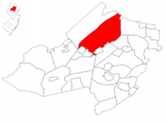
Census Bureau map of Rockaway Township, New Jersey
