White Plains, New York
From Wikipedia, the free encyclopedia http://en.wikipedia.org/
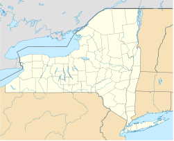
White Plains is a city and the county seat of Westchester County, New York, United States. It is located in south-central Westchester, about 4 miles (6Â km) east of the Hudson River and 2.5 miles (4.0 km) northwest of Long Island Sound. It is bordered to the north by the town of North Castle, to the north and east by the town/village of Harrison, to the south by the town/village of Scarsdale and to the west by the town of Greenburgh. As of the 2000 U.S. census, the city had a total population of 53,077, while a 2006 census estimate put the city’s population at 57,081. According to the city government, the daytime weekday population is estimated at 250,000.
Early History
At the time of the Dutch settlement of Manhattan in the early 17th century, the region had been used as farmland by the Weckquaeskeck tribe, members of the Mohican nation and was called “Quarropas”. To early traders it was known as “the White Plains”, either from the groves of white balsam which are said to have covered it,or from the heavy mist that local tradition suggests hovered over the swamplands near the Bronx River. The first non-native settlement came in November 1683, when a party of ConnecticutPuritans moved westward from an earlier settlement in Rye and bought about 4,400 acres (1,800ha), presumably from the Weckquaeskeck. However, John Richbell of Mamaroneck, claimed to have earlier title to much of the territory through his purchase of a far larger plot extending 20 miles (32 km) inland, perhaps from a different tribe. The matter wasn’t settled until 1721, when a Royal Patent for White Plains was granted by King George .
Early history:
In 1758, White Plains became the seat of Westchester County when the colonial government for the county left West Chester, which was located in what is now the northern part of the borough of the Bronx, in New York City. The unincorporated village remained part of the Town of Rye until 1788, when the Town of White Plains was created.
On July 9, 1776, a copy of the Declaration of Independence was delivered to the New York Provincial Congress, which was meeting in the county courthouse. The delegates quickly adopted a resolution approving the Declaration, thus declaring both the colony’s independence and the formation of the State of New York. The Declaration itself was first publicly read from the steps of the courthouse on July 11.
During September and October 1776, troops led by George Washington took up positions in the hills of the village, hotly pursued by the British under General Sir William Howe, who attacked on October 28. The Battle of White Plains took place primarily on Chatterton Hill, (later known as “Battle Hill,” and located just west of what was then a swamp but is now the downtown area) and the Bronx River. Howe’s force of 4,000-6,000 British and Hessian soldiers required three attacks before the Continentals, numbering about 1,600 under the command of Generals Alexander McDougall and Israel Putnam, retreated, joining Washington’s main force, which did not take part in the battle. Howe’s forces had suffered 250 casualties, a severe loss, and he made no attempt to pursue the Continentals, whose casualties were about 125 dead and wounded.
Three days after the battle Washington withdrew north of the village, which was then occupied by Howe’s forces. But after several inconclusive skirmishes over the next week Howe withdrew on November 5, leaving White Plains to the Continentals. Ironically, one of Washington’s subordinates, Major John Austin, who was probably drunk after having celebrated the enemy’s withdrawal, reentered the village with his detachment and proceeded to burn it down. Although he was court-martialed and convicted for this action, he escaped punishment.
The first United States Census, conducted in 1790, listed the White Plains population at 505, of whom 46 were slaves. (New York City’s population at that time was about 33,000.) By 1800, the population stood at 575 and in 1830, 830. By 1870, 26 years after the arrival of the New York Central Railroad, it had swollen to 2,630 and by 1890 to 4,508. In the decades that followed the count grew to 7,899 (1900) and 26,425 (1910). White Plains was incorporated as a village in 1866 and as a city in 1916.
 Â Seal
 Seal
|
Coordinates: 41°2′24″N 73°46′43″W / 41.04°N 73.77861°W / 41.04; -73.77861Coordinates: 41°2′24″N 73°46′43″W / 41.04°N 73.77861°W / 41.04; -73.77861 |
|
| United States | |
| New York | |
| Westchester | |
| Government | |
|
Type |
Mayor-Council |
| Tom Roach (D) | |
| Members’ List[show] | |
| Area | |
|
Total |
10.8 sq. mi (28 km2) |
|
Land |
10.4 sq. mi (26.9 km2) |
|
Water |
2.3 sq. mi (6 km2) |
| Elevation | 213 ft. (65 m) |
| Population (2000) | |
|
Total |
57,300 |
| Density | 5,305.6/sq. mi (2,048.5/km2) |
| Eastern (UTC-5) | |
|
Summer (DST) |
Eastern (UTC-4) |
| 10600-10699 | |
| 914 | |
| 36-81677 | |
|
GNIS feature ID |
0977432 |
|
Website |
cityofwhiteplains.com |
