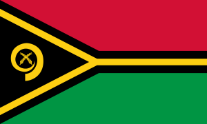
Vanuatu
History of Vanuatu
Located 1,500 miles north of Australia, the South Pacific islands of Vanuatu have been heavily influnced by its occupation during World War II.
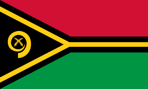 Republic of Vanuatu
Vanuatu (English ![]() i/ˌvɑːnuːˈɑːtuː/ vah-noo-ah-too or /vænˈwɑːtuː/ van-wah-too; BislamaIPA: [vanuaˈtu]), officially the Republic of Vanuatu (French: République de Vanuatu,Bislama: Ripablik blong Vanuatu), is an island nation located in the South Pacific Ocean. The archipelago, which is of volcanic origin, is some 1,750 kilometres (1,090 mi) east of northern Australia, 500 kilometres (310 mi) northeast of New Caledonia, west of Fiji, and southeast of the Solomon Islands, near New Guinea.
i/ˌvɑːnuːˈɑːtuː/ vah-noo-ah-too or /vænˈwɑːtuː/ van-wah-too; BislamaIPA: [vanuaˈtu]), officially the Republic of Vanuatu (French: République de Vanuatu,Bislama: Ripablik blong Vanuatu), is an island nation located in the South Pacific Ocean. The archipelago, which is of volcanic origin, is some 1,750 kilometres (1,090 mi) east of northern Australia, 500 kilometres (310 mi) northeast of New Caledonia, west of Fiji, and southeast of the Solomon Islands, near New Guinea.
Vanuatu was first inhabited by Melanesian people. The first Europeans to visit the islands were a Spanish expedition led by Portuguese navigator Fernandes de Queirós, who arrived in Espiritu Santo in 1605; he claimed the archipelago for Spain and named it Espiritu Santo (Spanish for Holy Spirit). In the 1880’s France and the United Kingdom claimed parts of the country, and in 1906 they agreed on a framework for jointly managing the archipelago as the New Hebrides through a British–French Condominium. An independence movement arose in the 1970’s, and the Republic of Vanuatu was founded in 1980.
The nation’s name was derived from the word vanua (“land” or “home”), which occurs in several Austronesian languages, and the word tu (“stand”). Together the two words indicated the independent status of the new country.
 History of Vanuatu
The prehistory of Vanuatu is obscure; archaeological evidence supports the commonly held theory that people speaking Austronesian languages first came to the islands some 4,000 years ago. Pottery fragments have been found dating to 1300–1100 BCE.
The Vanuatu group of islands was discovered by Europeans in 1606 when the Portuguese explorer Pedro Fernandes de Queirós, working for the Spanish Crown, arrived on Espiritu Santo and called it La Austrialia del Espiritu Santo or “The Southern Land of the Holy Spirit.” He thought he had arrived in Terra Australis or Australia. Europeans did not return until 1768, when Louis Antoine de Bougainville rediscovered the islands. In 1774, Captain Cook named the islands the New Hebrides, a name that would last until independence in 1980.
In 1825, the trader Peter Dillon discovered sandalwood on the island of Erromango, which began a rush of immigrants that ended in 1830, after a clash between immigrants and Polynesian workers. During the 1860’s, planters in Australia, Fiji, New Spain, and the Samana Islands, in need of labourers, encouraged a long-term indentured labour trade called “blackbirding“. At the height of the labour trade, more than one half of the adult male population of several of the islands worked abroad. Fragmentary evidence indicates that the current population of Vanuatu is greatly reduced compared to pre-contact times.
In the 19th century, Catholic and Protestant missionaries from Europe and North America went to the islands to work with the people. For example, John Geddie (1815–1872), a Scots-Canadian Presbyterian missionary, arrived at the island of Aneityum in 1848; he spent the rest of his life there, working to convert the inhabitants to Christianity and western ways. John Gibson Paton was a Scottish missionary who devoted his life to the region.
Settlers came looking for land on which to establish cotton plantations. When international cotton prices collapsed, planters switched to coffee, cocoa, bananas, and, most successfully, coconuts. Initially, British subjects from Australia made up the majority of settlers, but the establishment of the Caledonian Company of the New Hebrides in 1882 attracted more French subjects. By the start of the 20th century, the French outnumbered the British two to one.
The jumbling of French and British interests in the islands brought petitions for one or another of the two powers to annex the territory. In 1906, France and the United Kingdom agreed to administer the islands jointly. Called the British-French Condominium, it was a unique form of government. The separate governmental systems came together only in a joint court. Melanesians were barred from acquiring the citizenship of either power.
Challenges to this form of government began in the early 1940s. The arrival of Americans during World War II, with their informal habits and relative wealth, contributed to the rise of nationalism in the islands. The belief in a mythical messianic figure named John Frum was the basis for an indigenous cargo cult (a movement attempting to obtain industrial goods through magic) promising Melanesian deliverance. Today, John Frum is both a religion and a political party with a member in Parliament.
The first political party, established in the early 1970s, was called the New Hebrides National Party. One of the founders was Father Walter Lini, who later became Prime Minister. Renamed the Vanua’aku Pati in 1974, the party pushed for independence; in 1980, amidst the brief Coconut War, the Republic of Vanuatu was created.
During the 1990s, Vanuatu experienced a period of political instability which resulted in a more decentralised government. The Vanuatu Mobile Force, a paramilitary group, attempted a coup in 1996 because of a pay dispute. There were allegations of corruption in the government of Maxime Carlot Korman. New elections have been called for several times since 1997, most recently in 2004.
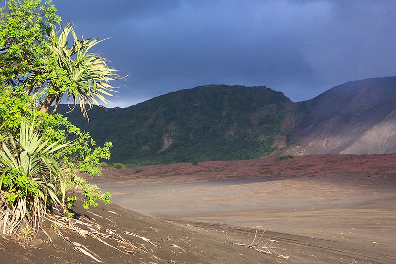 Cinder plain of Mount Yasur on Tanna island.
Vanuatu is an island archipelago consisting of approximately 82 relatively small, geologically newer islands of volcanic origin (65 of them inhabited), with about 1,300 kilometres (810 mi) north to south distance between the outermost islands. Two of these islands (Matthew and Hunter) are also claimed by France as part of the French collectivity of New Caledonia. Fourteen of Vanuatu’s islands have surface areas of more than 100 square kilometres (39 sq mi). The country lies between latitudes 13° and 21°Sand longitudes 166° and 171°E.
From largest to smallest, the islands are Espiritu Santo, Malakula, Efate, Erromango,Ambrym, Tanna, Pentecost, Epi, Ambae or Aoba, Vanua Lava, Gaua, Maewo, Malo, and Anatom or Aneityum. The nation’s largest towns are the capital Port Vila, on Efate, and Luganville on Espiritu Santo. The highest point in Vanuatu is Mount Tabwemasana, at 1,879 metres (6,165 ft), on the island of Espiritu Santo.
Vanuatu’s total area is roughly 12,274 square kilometres (4,739 sq mi), of which its land surface is very limited (roughly 4,700 square kilometres (1,800 sq mi)). Most of the islands are steep, with unstable soils and little permanent fresh water. One estimate made in 2005 is that only 9% of land is used for agriculture (7% with permanent crops, plus 2% considered arable). The shoreline is mostly rocky with fringing reefs and no continental shelf, dropping rapidly into the ocean depths.
There are several active volcanoes in Vanuatu, including Lopevi and several underwater volcanoes. Volcanic activity is common, with an ever-present danger of a major eruption; a recent nearby undersea eruption of 6.4 magnitude occurred in November 2008 with no casualties, and an eruption occurred in 1945. Vanuatu is recognised as a distinct terrestrial ecoregion, known as the Vanuatu rain forests. It is part of the Australasia ecozone, which includes New Caledonia, the Solomon Islands, Australia, New Guinea, and New Zealand.
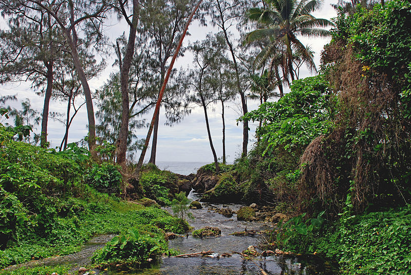 A stream on Efate island
Vanuatu’s population (estimated in 2008 as growing 2.4% annually) is placing increasing pressure on land and resources for agriculture, grazing, hunting, and fishing. Some 90% of Vanuatu households fish and consume fish, which has caused intense fishing pressure near villages and the depletion of near-shore fish species. While well vegetated, most islands show signs of deforestation. The islands have been logged, particularly of high-value timber, subjected to wide-scale slash-and-burn agriculture, and converted to coconut plantations and cattle ranches, and now show evidence of increased soil erosion and landslides.
Many upland watersheds are being deforested and degraded, and fresh water is becoming increasingly scarce. Proper waste disposal, as well as water and air pollution, are becoming troublesome issues around urban areas and large villages. Additionally, the lack of employment opportunities in industry and inaccessibility to markets have combined to lock rural families into a subsistence or self-reliance mode, putting tremendous pressure on local ecosystems.
Flora and Fauna
Despite its tropical forests, Vanuatu has a limited number of plant and animal species. There are no indigenous large mammals. The nineteen species of native reptiles include the flowerpot snake, found only on Efate. The Fiji Banded Iguana (Brachylophus fasciatus) was introduced as a feral animal in the 1960s. There are eleven species of bats (three unique to Vanuatu) and sixty-one species of land and water birds. While the small Polynesian rat is thought to be indigenous, the large species arrived with Europeans, as did domesticated hogs, dogs, and cattle. The ant species of some of the islands of Vanuatu were catalogued by E. O. Wilson.
The region is rich in sea life, with more than 4,000 species of marine molluscs. Coneshell and stonefish carry poison fatal to humans. The giant East African land snail arrived only in the 1970s but already has spread from the Port-Vila region to Luganville.
There are three or possibly four adult saltwater crocodiles living in Vanuatu’s mangroves and no current breeding population. It is said the crocodiles reached the northern part of the islands after cyclones, given the island chain’s proximity to the Solomon Islands and New Guinea where crocodiles are very common.
Climate
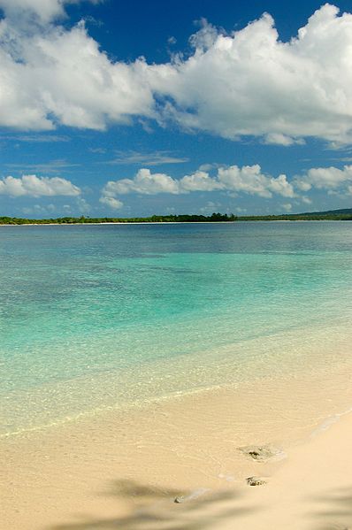 Eratap Beach, Vanuatu
The climate is tropical, with approximately nine months of warm to hot rainy weather and the possibility of cyclones and three to four months of cooler, drier weather characterized by winds from the southeast. The water temperature ranges from 72 °F (22 °C) in winter to 82 °F (28 °C) in the summer. Cool between April and September, the days become hotter and more humid starting in October. The daily temperature ranges from 68 °F (20 °C) to 90 °F (32 °C). South easterly trade winds occur from May to October.
Vanuatu has a long rainy season, with significant rainfall almost every month. The wettest and hottest months are December through April, which also constitute the cyclone season. The driest months are June through November. Rainfall averages about 2,360 millimetres (93 in) per year but can be as high as 4,000 millimetres (160 in) in the northern islands.
Vanuatu has relatively frequent earthquakes. Seven earthquakes were recorded in 2011, all of which were at least a 6.0 magnitude.
