Guam
Guam History (Guam’s Military Build Up)
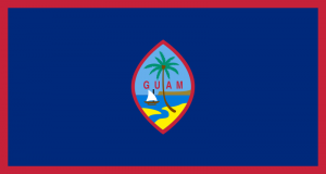
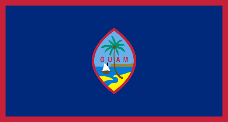 Flag
Flag
Guam (![]() i/ˈɡwɑːm/; Chamorro: Guåhån) is an organized, unincorporated territory of the United States in the western Pacific Ocean. It is one of five U.S. territories with an established civilian government. Guam is listed as one of seventeen Non-Self-Governing Territories by the Special Committee on Decolonization of the United Nations. The island’s capital is Hagåtña (formerly named Agana). Guam is the largest and southernmost of the Mariana Islands.
i/ˈɡwɑːm/; Chamorro: Guåhån) is an organized, unincorporated territory of the United States in the western Pacific Ocean. It is one of five U.S. territories with an established civilian government. Guam is listed as one of seventeen Non-Self-Governing Territories by the Special Committee on Decolonization of the United Nations. The island’s capital is Hagåtña (formerly named Agana). Guam is the largest and southernmost of the Mariana Islands.
The Chamorros, Guam’s indigenous people, first populated the island approximately 4,000 years ago. The island has a long history of European colonialism, beginning with Ferdinand Magellan‘s Spanish expedition landing on March 6, 1521. The first colony was established in 1668 by Spain with the arrival of settlers including Padre San Vitores, a Catholic missionary. For more than two centuries Guam was an important stopover for the Spanish Manila Galleons that crossed the Pacific annually. The island was controlled by Spain until 1898, when it was surrendered to the United States during the Spanish–American War and later formally ceded as part of the Treaty of Paris.
As the largest island in Micronesia and the only U.S.-held island in the region before World War II, Guam was captured by the Japanese on December 8, 1941, just hours after the attack on Pearl Harbor, and was occupied for two and a half years. During the occupation, the people of Guam were subjected to acts that included torture, beheadings, and rape, and were forced to adopt the Japanese culture. Guam was subject to fierce fighting when U.S. troops recaptured the island on July 21, 1944, a date commemorated every year as Liberation Day.
Today, Guam’s economy is supported by its principal industry, tourism, which is composed primarily of visitors from Japan. Guam’s second largest source of income is the United States military.
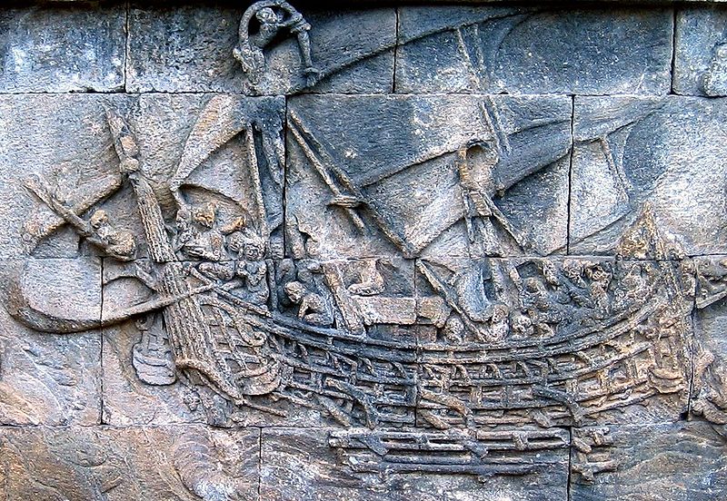 A Borobudur ship carved on Borobudur, c. 800 CE. Indonesian outrigger boats may have made trade voyages to the east coast of Africa as early as the 1st century CE.
Guam was first discovered by people from southeastern Indonesia around 2000 BC. Most of what is known about pre-contact (“ancient”) Chamorros comes from legends and myths, archaeological evidence, Jesuit missionary accounts, and observations from visiting scientists like Otto von Kotzebue and Louis de Freycinet.
When Europeans first arrived on Guam, Chamorro society had three classes: matua (upper class), achaot (middle class), andmana’chang (lower class). The matua were located in the coastal villages, which meant they had the best access to fishing grounds, whereas the mana’chang were located in the interior of the island. Matua and mana’chang rarely communicated with each other, andmatua often used achaot as an intermediary. There were also “makåhna” (similar to shamans), skilled in healing and medicine. Belief in spirits of ancient Chamorros called “Taotao mo’na” still persists as a remnant of pre-European culture. When Magellan arrived on Guam, he was greeted by hundreds of small outrigger canoes that appeared to be flying over the water, due to their considerable speed. These outrigger canoes were called Proas, and resulted in Magellan naming Guam Islas de las Velas Latinas(“Islands of the Lateen sails“).
Guam, the only Spanish outpost in the Pacific Ocean east of the Philippines, became the regular port between Acapulco, Mexico, and Manila from 1565 to 1815, and (since Philippine independence) the most western outpost of actual United States territory in the Pacific. It is the biggest single segment of Micronesia, the largest islands between the islands of Kyushu (Japan), New Guinea, the Philippines, and the Hawaiian Islands.
Latte stones are stone pillars that are found only in the Mariana Islands and are a recent development in Pre-Contact Chamorro society. The latte stone was used as a foundation on which thatched huts were built. Latte consist of a base shaped from limestone called the haligi and with a capstone, or tåsa, made either from a large brain coral or limestone, placed on top. Using carbon-dating, archaeologists have broken Pre-Contact Guam (i.e. Chamorro) history into three periods: “Pre-Latte” (BC 2000? to AD 1) “Transitional Pre-Latte” (AD 1 to AD 1000), and “Latte” (AD 1000 to AD 1521).
Archaeological evidence also suggests that Chamorro society was on the verge of another transition phase by 1521, as latte stones became bigger. Assuming the larger latte stones were used for chiefly houses, it can be argued that Chamorro society was becoming more stratified, either from population growth or the arrival of new people. The theory remains tenuous, however, due to lack of evidence, but if proven correct, would support the idea that Pre-Contact Chamorros were in a transitioning society.
Spanish Colonization and the Manila Galleons
Portuguese navigator Ferdinand Magellan, sailing for the King of Spain, reached the island in 1521 during his fleet’s circumnavigation of the globe. General Miguel López de Legazpi claimed Guam for Spain in 1565. Spanish colonization commenced in 1668 with the arrival of Padre San Vitores, who established the first Catholic mission. The islands were part of the Spanish East Indies governed from the Philippines, which were in turn part of the Viceroyalty of New Spain based in Mexico City.
Between 1668 and 1815, Guam was an important resting stop for the Spanish Manila galleons, a fleet that covered the Pacific trade route between Acapulco (Mexico) and Manila (Philippines). To protect these Pacific fleets, Spain built a number of defensive structures such as Fort Nuestra Señora de la Soledad in Umatac, which are still standing today. Other reminiscences of colonial times include the old Governor’s Palace in Plaza de España and the Spanish Bridge, both in Hagatña. Guam’s Cathedral Dulce Nombre de Maria was also built during Spanish times in the 17th century. Guam, along with the rest of the Mariana and Caroline Islands, were treated as part of Spain’s colony in the Philippines. While Guam’s Chamorro culture has indigenous roots, the cultures of both Guam and the Northern Marianas have many similarities with Spanish and Mexican culture due to three centuries of Spanish rule.
The Spanish-American War and World War II


The United States took control of the island in the 1898 Spanish-American War, as part of the Treaty of Paris. Guam came to serve as a station for American ships traveling to and from the Philippines, while the Northern Mariana Islands passed to Germany, and then to Japan.
During World War II, Guam was attacked and invaded by the armed forces of Japan on December 8, 1941.
The Northern Mariana Islands had become a Japanese protectorate before the war. It was the Chamorros from the Northern Marianas who were brought to Guam to serve as interpreters and in other capacities for the occupying Japanese force. The Guamanian Chamorros were treated as an occupied enemy by the Japanese military. After the war, this would cause resentment between the Guamanian Chamorros and the Chamorros of the Northern Marianas. Guam’s Chamorros believed their northern brethren should have been compassionate towards them, whereas having been occupied for over 30 years, the Northern Mariana Chamorros were loyal to Japan.
Guam’s Japanese occupation lasted for approximately thirty-one months. During this period, the indigenous people of Guam were subjected to forced labor, family separation, incarceration, execution, concentration camps and forced prostitution. Approximately one thousand people died during the occupation, according to Congressional Testimony in 2004. Some historians estimate that war violence killed 10% of Guam’s some 20,000 population.
The United States returned and fought the Battle of Guam on July 21, 1944, to recapture the island from Japanese military occupation. More than 18,000 Japanese were killed as only 485 surrendered. Sergeant Shoichi Yokoi, who surrendered in January 1972, appears to have been the last confirmed Japanese holdout in Guam. The United States also captured and occupied the Northern Marianas.
Post-War
After the war, the Guam Organic Act of 1950, established Guam as an unincorporated organized territory of the United States, provided for the structure of the island’s civilian government, and granted the people U.S. citizenship. Since Guam is not a U.S. state, U.S. citizens residing on Guam are not allowed to vote for president and their congressional representative is a non-voting member. On August 6, 1997, Guam was the site of the Korean Air Flight 801 aircraft accident. The Boeing 747-300 jetliner was preparing to land when it crashed into a hill, killing 228 of the 254 people on board.
Since 1974, about 124 historic sites in Guam have been recognized under the U.S. National Register of Historic Places.
Geography


Guam lies between 13.2°N and 13.7°N and between 144.6°E and 145.0°E, and has an area of 212 square miles (549 km2), making it the 32nd largest island of the United States. It is the southernmost and largest island in the Mariana island chain and is also the largest island in Micronesia. This island chain was created by the colliding Pacific and Philippine Sea tectonic plates. Guam is the closest land mass to the Mariana Trench, a deep subduction zone, that lies beside the island chain to the east. Challenger Deep, the deepest surveyed point in the Oceans, is southwest of Guam at 35,797 feet (10,911 m) deep. The highest point in Guam is Mount Lamlam at an elevation of 1,332 feet (406 metres).
The island of Guam is 30 miles (48 km) long and 4 to 12 miles (6 to 19 km) wide, 3/4 the size of Singapore. The island experiences occasional earthquakes due to its location on the western edge of the Pacific Plate and near the Philippine Sea Plate. In recent years, earthquakes with epicenters near Guam have had magnitudes ranging from 5.0 to 8.7. Unlike the Anatahan volcano in theNorthern Mariana Islands, Guam is not volcanically active. However, due to its proximity to Anatahan, vog (i.e., volcanic smog) does occasionally affect Guam.
A coral table reef with deepwater channels surrounds most of Guam. Sandy beaches, rock cliff lines and mangroves characterize the coastline area. Sheer limestone coastal cliffs dominate the north, while the southern end of the island is mountainous, with lower hills in between.
Climate
The climate is characterized as tropical marine. The weather is generally hot and very humid with little seasonal temperature variation. The mean high temperature is 86 °F (30 °C) and mean low is 76 °F (24 °C) with an average annual rainfall of 96 inches (2,180 mm). The dry season runs from December through June. The remaining months (July through November) constitute the rainy season. The months of January and February are considered the coolest months of the year with night time temperatures in the mid to low 70s and generally lower humidity levels. The highest risk of typhoons is during October and November. They can, however, occur year-round.
Guam is located in Typhoon Alley and it is common for the island to be threatened by tropical storms and possible typhoons during the wet season. The most intense typhoon to pass over Guam recently was Super Typhoon Pongsona, with sustained winds of 144 miles per hour, gusts to 173 miles per hour, which slammed Guam on December 8, 2002, leaving massive destruction.
Since Super Typhoon Pamela in 1976, wooden structures have been largely replaced by concrete structures. During the 1980s wooden utility poles began to be replaced by typhoon-resistant concrete and steel poles. After the local Government enforced stricter construction codes, many home and business owners built their structures out of reinforced concrete with installed typhoon shutters.
