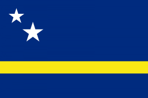
Curaçao
Curaçao: The Heart of the Caribbean

Curaçao (/ˈkjʊərəsaʊ/ kewr-ə-sow; Dutch: Curaçao; Papiamentu: Kòrsou) is an island in the southern Caribbean Sea, off the Venezuelan coast. The Country of Curaçao (Dutch: Land Curaçao; Papiamento: Pais Kòrsou), which includes the main island plus the small, uninhabited island of Klein Curaçao (“Little Curaçao”), is a constituent country of the Kingdom of the Netherlands. It has a population of over 140,000 on an area of 444 km2 (171 sq mi) and its capital is Willemstad.
Prior to 10 October 2010, when the Netherlands Antilles was dissolved, Curaçao was administered as the Island Territory of Curaçao (Dutch: Eilandgebied Curaçao, Papiamentu: Teritorio Insular di Kòrsou), one of five island territories of the former Netherlands Antilles.
Etymology
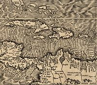 Map from 1562 with Curaçao indicated as Qúracao.
One explanation for the origin of the name Curaçao is that it is derived from the Portuguese word for heart (coração), referring to the island as a centre in trade. Spanishtraders kept the name as Curaçao, which was followed by the Dutch. Another explanation is that Curaçao was the name the Arawak peoplehad used to identify themselves.
On a map created by Hieronymus Cock in 1562 in Antwerp, the island was referred to as Qúracao.
Four British Royal Navy ships have been named after the Island between 1809 and 1942. All have used the unusual spelling HMS Curacoa. The last of these was a C-class light cruiser of 1917.
The name “Curaçao” has become associated with a shade of blue, because of the deep-blue version of the liqueur named Curaçao (also known as Blue Curaçao).
History
 Map of Curaçao in 1836. – History of Curaçao
The original inhabitants of Curaçao were Arawak peoples. Their ancestors had migrated to the island from the mainland of South America, likely hundreds of years before European encounter.
The first Europeans recorded as seeing the island were members of a Spanish expedition under the leadership of Alonso de Ojeda in 1499. The Spaniards enslaved most of the Arawak as their labor force. They sometimes forcibly relocated the survivors to other colonies where workers were needed. In 1634, after the Netherlands achieved independence from Spain, Dutch colonists started to occupy the island. European powers were trying to get bases in the Caribbean.
The Dutch West India Company founded the capital of Willemstad on the banks of an inlet called the ‘Schottegat.’ Curaçao had been ignored by colonists, because it lacked gold deposits. The natural harbour of Willemstad proved to be an ideal spot for trade. Commerce and shipping — and piracy—became Curaçao’s most important economic activities. In addition, in 1662 the Dutch West India Company made Curaçao a centre for the Atlantic slave trade, often bringing slaves here for sale elsewhere in the Caribbean.
Sephardic Jews settled here with the Dutch and in then-Dutch Brazil; they have had a significant influence on the culture and economy of the island. Some merchants were part of the Dutch colonial slave trade.
In the Franco-Dutch War, Count Jean II d’Estrées planned to attack Curaçao. His fleet — 12 men of war, 3 fireships, 2 transports, a hospital ship, and 12 privateers — met with disaster, losing 7 men of war and 2 other ships when they struck reefs off the Las Aves archipelago. They had made a serious navigational error, hitting the reefs on 11 May 1678, a week after setting sail from Saint Kitts. Curaçao marked the events by a Day of Thanksgiving, celebrated for decades into the 18th century, to commemorate the island’s fortunate escape from being invaded by the French.
Although a few plantations were established on the island by the Dutch, the first profitable industry established on Curaçao was salt mining. The mineral was a lucrative export at the time and was a major factor for the island being part of international commerce.
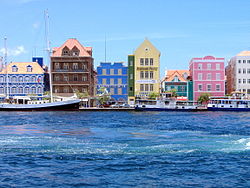 Dutch architecture along Willemstad‘s harbour.
Many Dutch colonists grew affluent from the slave trade, and the city built impressive colonial buildings. Curaçao architecture blends Dutch and Spanish colonial styles. The wide range of historic buildings in and around Willemstad has resulted in the capital being designated as a UNESCO World Heritage Site. Landhouses (former plantation estates) and West African style kas di pal’i maishi(former slave dwellings) are scattered all over the island. Some have been restored and can be visited.
In 1795, a major slave revolt took place under the lead of Tula Rigaud, Louis Mercier, Bastian Karpata, and Pedro Wakao. Up to 4000 slaves on the northwest section of the island revolted. Over a thousand of the slaves were involved in heavy gunfights. After a month, the slave owners suppressed the revolt.
Curaçao’s proximity to South America resulted in interaction with cultures of the coastal areas. For instance, architectural similarities can be seen between the 19th-century parts of Willemstad and the nearby Venezuelan city of Coro in Falcón State. The latter has also been designated a UNESCO World Heritage Site. In the 19th century, Curaçaoans such as Manuel Piar and Luis Brión were prominently engaged in the wars of independence of Venezuela and Colombia. Political refugees from the mainland (such as Simon Bolivar) regrouped in Curaçao. Children from affluent Venezuelan families were educated on the island.
 Luis Brión, a Curaçao-born Venezuelan admiral.
During the 18th and 19th centuries, the island changed hands among the British, the French, and the Dutch several times. In the early 19th century, Portuguese and Lebanese migrated to Curaçao attracted by the business opportunities. Stable Dutch rule returned in 1815, at the end of the Napoleonic wars, when the island was incorporated into the colony of Curaçao and Dependencies.
The Dutch abolished slavery in 1863, creating a change in the economy with the shift to free labor. Some inhabitants of Curaçao emigrated to other islands, such as Cuba, to work in sugar cane plantations.
Other former slaves had no place to go and remained working for the plantation owner in the tenant farmer system. This was an instituted order in which the former slave leased land from his former master. In exchange the tenant promised to give up most of his harvest to the former slave master. This system lasted until the beginning of the 20th century.
Historically, Dutch was not widely spoken on the island outside of colonial administration; its use increased in the late 19th and early 20th century. Students on Curaçao, Aruba, and Bonaire were taught predominantly in Spanish up until the late 19th century. There were also efforts to introduce bilingual popular education in Dutch and Papiamentu in the late 19th century (van Putte 1999).
When in 1914, oil was discovered in the Maracaibo Basin town of Mene Grande, the fortunes of the island were dramatically altered. Royal Dutch Shell and the Dutch Government had built an extensive oil refinery installation on the former site of the slave-trade market at Asiento. The oil company suddenly had many jobs for the local population and attracted a wave of immigration from surrounding nations. Curaçao was an ideal site for the refinery, as it was away from the social and civil unrest of the South American mainland, but near enough to the Maracaibo Basin oil fields. It had an excellent natural harbor that could accommodate large oil tankers.
East and South Asian immigrants arrived during the economic boom of the early 20th century. Shell brought affluence to the island. Large scale housing was provided and Willemstad developed an extensive infrastructure. However, discrepancies appeared among the social groups of Curaçao. The discontent and the antagonisms between Curaçao social groups culminated in rioting and protest on 30 May 1969. The civil unrest fueled a social movement that resulted in the local Afro-Caribbean population attaining more influence over the political process (Anderson and Dynes 1975).
in the early 20th century, Dutch was made the sole language of instruction in the educational system to facilitate schooling for the children of expatriate employees of Royal Dutch Shell (Romer, 1999). Papiamentu, the local Creole language, was tentatively re-introduced in the school curriculum during the mid-1980’s.
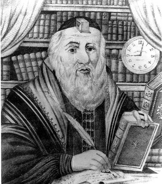 The Yivo Institute for Jewish Research’s Exhibt Mattityahu Strashun, 1817-1885.
The years before and after World War II, Ashkenazi Jews emigrated from Eastern Europe, many of whom were Romanian Jews.
Curaçao gained self-government on 1 January 1954, as an island territory of the Netherlands Antilles. The islanders did not fully participate in the political process until after the social movements of the late 1960’s.
The island has developed a tourist industry and offered low corporate taxes to encourage companies to set up holdings in order to avoid higher taxes elsewhere. it has emphasized its diverse heritage to expand its tourism industry. Since the late 20th century, immigrants have come from neighbouring countries, such as Venezuela, but also from the Dominican Republic, Haiti, and the Anglophone Caribbean and Colombia. In the early 21st century, a number of Dutch pensioners (pensionados) have settled on the island for its mild climate.
In the mid-1980s, Royal Dutch Shell sold the refinery for a symbolic amount to a local government consortium. The aging refinery has been the subject of lawsuits in recent years, which charge that its emissions, including sulfur dioxide and particulate matter, far exceed safety standards. The government consortium currently leases the refinery to the Venezuelan state oil company PDVSA.
On 2 July 1984, the 30th anniversary of the first elected Island Council, the council inaugurated the National Flag and the official anthem. Since then, the movement to separate the island from the Antillean federation has steadily become stronger. In the 2000s, the political relationship with the other islands of the Netherlands Antilles, and with the Netherlands, came under discussion again. In a referendum held on 8 April 2005, the residents voted for separate status outside the Netherlands Antilles, similar to Aruba. They rejected the options for full independence, becoming part of the Netherlands, or retaining the status quo.
 24th Prime Minister of the Netherlands Antilles
In 2006, Emily de Jongh-Elhage, a resident of Curaçao, was elected as the new Prime Minister of the Netherlands Antilles.
On 1 July 2007, the island of Curaçao was due to become a country within the Kingdom of the Netherlands. On 28 November 2006, the island council rejected a clarification memorandum on the process. On 9 July 2007, the new island council of Curaçao ratified the agreement previously rejected in November 2006. On 15 December 2008, Curaçao was scheduled to become a separate country within the Kingdom of the Netherlands (like Aruba and the Netherlands Antilles that time). A non-binding referendum on this plan took place in Curaçao on 15 May 2009, in which 52 percent of the voters supported these plans.
The dissolution of the Netherlands Antilles came into effect on 10 October 2010. Curaçao became a country within the Kingdom of the Netherlands, with the Kingdom retaining responsibility for defence and foreign policy. The Kingdom was also to oversee the island’s finances under a debt-relief arrangement agreed between the two. Curaçao’s first Prime Minister was Gerrit Schotte. He was succeeded in 2012 by Stanley Betrian, ad interim. After elections in 2012 Daniel Hodge became the third Prime Minister on 31 December 2012. He led a demissionary cabinet until 7 June 2013, when a new cabinet under leadership of current Prime Minister Ivar Asjes was sworn in.
Due to an economic slump in recent years, emigration to the Netherlands has been high. Emigration from surrounding Caribbean islands, Latin American countries and the Netherlands has taken place.
Recent political debate has centered on the issue of Papiamentu becoming the sole language of instruction. Proponents argue that it will help preserve the language and will improve the quality of primary and secondary school education. Proponents of Dutch-language instruction argue that students who study in Dutch will be better prepared for the university education offered to Curaçao residents in the Netherlands.
Forts
When the Dutch arrived in 1634, they built forts at key points around the island to protect themselves from foreign powers, privateers, and pirates. Five of the best preserved forts can still be seen today:
- Waterfort (1634)
- Fort Amsterdam (1635)
- Fort Beekenburg (1703)
- Fort Nassau (1797)
- Riffort (1828)
- Piscadera Bay Fort (built between 1701–1704)
Four of these forts are placed in a 2 miles (3.2 km) radius, protecting the island primary natural harbor that once was the center of the slave trade. Waterfort, Fort Amsterdam and Riffort are less than 300 yards (270 m) apart, protecting the entrance to the harbor.
In 1957, Hotel Van der Valk Plaza Curaçao was built on top of the Waterfort.
The Piscadera bay fort became an fundamental part of the Hilton Curaçao hotel that opened in 1967. The fort is being used as historic back drop for different types of weddings and events.
The Riffort contains restaurants, and shops. It is located on the opposite side of the Waterfort across the entrance to the harbor. In 2009, the Renaissance Curaçao Resort and Casino opened next to the Riffort.
Geography
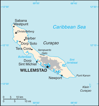 A map of Curaçao.
The southern coast has calm waters. The coastline has bays and inlets.
Flora
The flora of Curaçao differs from the typical tropical island vegetation. Xeric scrublands are common, with various forms of cacti, thorny shrubs, evergreens, and the island’s national tree, divi-divis. Curaçao’s highest point is the Sint Christoffelberg 375 m (1,230 ft). 10 kilometres (6.2 mi) off the coast of Curaçao, to the south-east, lies the small, uninhabited island of Klein Curaçao (“Little Curaçao”).
Climate
Curaçao has a tropical savannah climate (Köppen climate classification As) with a dry season from January to September and a wet season from October to December. The temperatures are relatively constant with small differences throughout the year. The trade winds bring cooling during the day and the same trade winds bring warming during the night. The coldest month is January with an average temperature of 26.5 °C (80 °F) and the warmest month is September with an average temperature of 28.9 °C (84 °F). The year’s average maximum temperature is 31.2 °C (88 °F). The year’s average minimum temperature is 25.3 °C (78 °F).
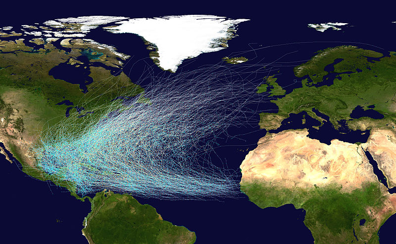 Hurricane tracks since 1851.
Curaçao lies outside the hurricane belt, but is still occasionally affected by hurricanes, as for example Hazel in 1954, Anna in 1961 Felix in 2007 and Omar in 2008. A landfall of a hurricane in Curaçao has not occurred since the United States National Hurricane Center started tracking hurricanes. Curaçao has, however, been directly affected by pre-hurricane tropical storms several times; the latest which did so were Tomas in 2010, Cesar in 1996, Joan-Miriam in 1988, Cora and Greta in 1978, Edith and Irene in 1971 and Francelia in 1969. The latest, Tomas, brushed Curaçao as a tropical storm, dropping as much as 265 mm (10.4 in) of precipitation on the territory, nearly half of the annual precipitation in one day. This made Tomas one of the wettest events in the island’s history, as well as one of the most devastating; its flooding killed two people and caused over NAƒ60 million (US$28 million) in damage.
